Mirai and GreenValley Plan Local LiDAR Assembly and Calibration in India
An initial agreement covers assembly, support and geospatial software applications. Investment, licensing and production scope still need definitive agreements.
Manik Gupta
Founder and editor of DeepTech India. Manik writes about India's frontier technology ecosystem — AI, semiconductors, space, quantum, robotics and biotech — translating research and policy into clear, reliable reporting.
Backlog edition: 18 September 2026. Reviewed on 20 September; agreement reported on 16 September.
Mirai Aerospace and GreenValley International have signed an initial agreement to develop LiDAR assembly, manufacturing and support capabilities in India. The practical opportunity is to connect imported sensing technology with local maintenance, calibration and application development.
The announcement does not establish that a production line is operating. PTI's account says definitive agreements covering investment, technology licensing and production scope are expected to be negotiated over the coming months.
What the partners propose
Mirai plans an Indian service and calibration centre, with assembly preceding deeper localisation as volumes grow. GreenValley is to supply assembly kits, technical documentation and quality standards. The partners also intend to work on point-cloud processing, automated feature extraction and digital-twin applications.
Those proposals build on an existing distribution relationship. The distinction matters: selling and supporting a product, assembling it locally and manufacturing its key components are different levels of capability.
The hardware already available
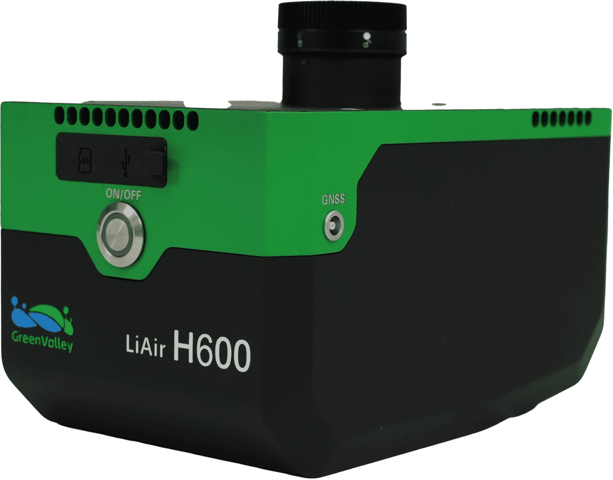
Mirai's official catalogue includes GreenValley's LiAir H-series airborne LiDAR systems. These combine laser scanning with positioning and imaging to collect three-dimensional survey data. The photograph accompanying this article shows the existing H600 product; it is not an image of a newly established Indian factory.
The catalogue distinguishes the H600 from the H800. It lists the H600 at 1.3 kilograms and the H800 at 2.25 kilograms, with different range and data-rate specifications. The largest performance number on a family page should not automatically be assigned to every model. These remain supplier specifications rather than results from independent testing here.
Why calibration deserves attention
For a mapping customer, the useful output is reliable survey data. A sensor's advertised range alone cannot establish that a finished map is accurate. Installation, positioning information, calibration and processing all affect the result.
Local service could therefore be a meaningful part of this agreement even before substantial component manufacturing begins. The next evidence to watch is the completed commercial agreement, the scope of the service centre and results from actual deployments. Announced localisation is a starting point; operating capability needs to be demonstrated.
Image: GreenValley LiAir H600 from Mirai Aerospace's official catalogue. Credit: GreenValley International / Mirai Aerospace.
Sources
Tags
More from Robotics
BonV Aero Joins GENIUS NY’s Tenth Cohort for Heavy-Lift Drone Development
The Odisha company is one of five finalists in the yearlong accelerator, with investment awards to be decided at the May 2027 pitch finals.
Alteon Raises $2.5 Million to Build Aircraft That Ride Ocean Wind Like an Albatross
Bengaluru's Alteon has raised a $2.5 million pre-seed round to build autonomous aircraft that use dynamic soaring — the wind-shear trick albatrosses use — to stay airborne for months without fuel.